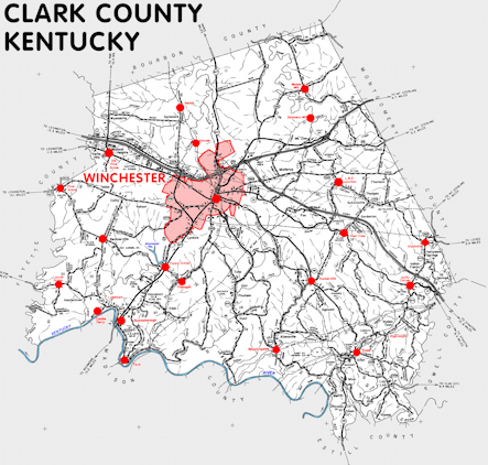
Clark county is in the Outer Bluegrass region of Kentucky. The elevation in the county ranges from 549 to 1120 feet above sea level.
It was formed in 1793 from Bourbon and Fayette counties. The county seat is Winchester. Clark county was a source of Montgomery (1797), Estill (1808), and Powell (1852) counties.
In 2020 the county population was 36,972 in a land area of 252.46 square miles, an average of 146.4 people per square mile.
The equine population was 2,200 in the 2012 Kentucky Equine Survey.
Clark county is in the Lexington-Fayette metro statistical area and the Bluegrass Area Development District. It is in the Appalachian region according to the Appalachian Regional Commission.
Clark county was named to honor General George Rogers Clark, who served in the American Revolution. The name was usually spelled Clarke before 1850.


SEARCH THE KENTUCKY ATLAS & GAZETTEER
© 2024 David C. Elbon
