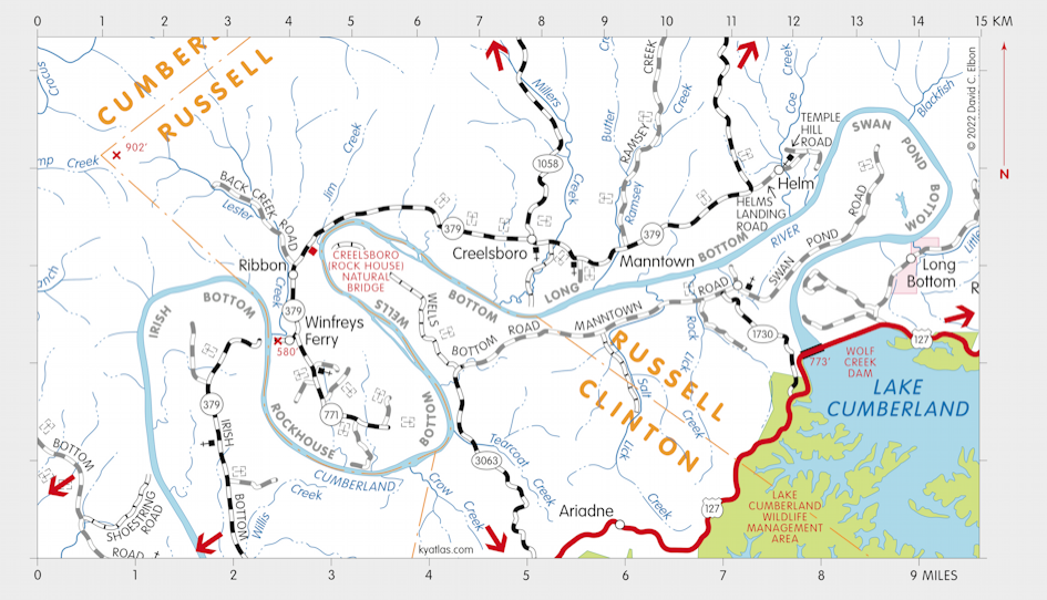
Creelsboro, Kentucky

Creelsboro is a Russell county community near the Cumberland River about 10 miles southwest of Jamestown. It was established as Creelsburgh in 1819 at or near the site of William Campbell's Ferry and may first have been known as Campbellsburg. The Creels were a local pioneer family.
The Creesburgh post office opened in 1828, was renamed Creelsborough in 1864, although it was later spelled Creelsboro. It closed in 1962.
About three miles southeast of Creelsboro is the Wolf Creek Dam, which impounds the Cumberland River to create Lake Cumberland, which covers about 63,000 acres. The dam was completed in 1950. The name comes from the original planned location of the dam several miles upstream on the Cumberland River at Wolf Creek.
About three miles west of Creelsboro, where Jim Creek enters the Cumberland River, is the Creelsboro or Rock House Natural Bridge. It is 104 feet long and is one of the longest in the United States. It is a National Natural Landmark.
SEARCH THE KENTUCKY ATLAS & GAZETTEER
© 2024 David C. Elbon