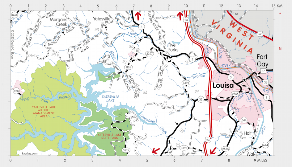
Louisa, Kentucky

Louisa, the seat of Lawrence county, is located where the Tug and Levisa Forks of the Big Sandy River meet. Settlement was attempted in 1789 at The Point, between the forks, but it was abandoned. A settlement called Balclutha may have existed for a short time afterward west of The Point. The settlement that became Louisa began about 1815. The sources of the names are obscure.
Louisa was incorporated sometime before 1869.
The Forks of Big Sandy post office opened in 1819, closed soon after, and the Louisa post office opened in 1822.
The population in 2020 was 2,668.
The Big Sandy River Lock and Dam 3 was located at Louisa. It was also known as the Fort Gay Lock and Dam, for the nearby town in West Virginia. Construction began in 1883 and was completed in 1897. Locking end in 1947.
MORE INFORMATION
- Lawrence County Clerk
- Lawrence County Fiscal Court
- Lawrence County Public Library
- Lawrence County Schools
- Lawrence County Tourism Commission
- Louisa, City of
SEARCH THE KENTUCKY ATLAS & GAZETTEER
© 2024 David C. Elbon