Kentucky Atlas and Gazetteer

Fort Mitchell, Kentucky
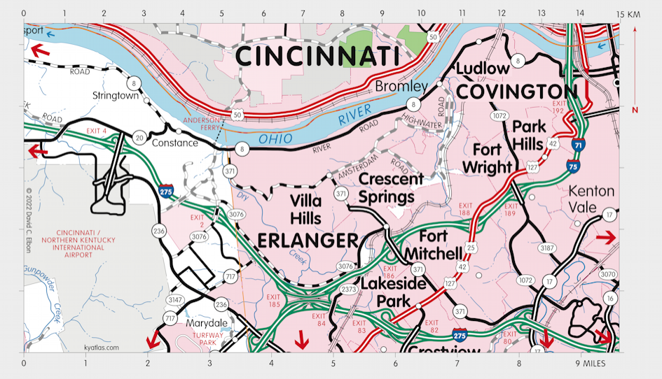

Fort Mitchell is a Kenton county city on US 25 to the west of Covington. It is on the site of fortifications built to defend Cincinnati and northern Kentucky during the Civil War and was named for General Ormsby McKnight Mitchel, a professor at Cincinnati College (now the University of Cincinnati) who designed them. (The reason for the difference in the spellings is obscure.) Fort Mitchell was incorporated in 1910 and has never had a post office. The population in 2010 was 8,207.

MORE INFORMATION

Anderson Ferry Constance, Kentucky Covington, Kentucky To Taylor Mill, Kentucky To Elsmere, Kentucky To Hebron, Kentucky To Taylorsport, Kentucky Edgewood, Kentucky Crestview Hills, Kentucky Lakeside Park, Kentucky Fort Mitchell, Kentucky Fort Wright, Kentucky Erlanger, Kentucky Crescent Springs, Kentucky Taylor Mill, Kentucky Park Hills, Kentucky Kenton Vale, Kentucky Ludlow, Kentucky Bromley, Kentucky Villa Hills, Kentucky Turfway Park Florence, Kentucky Florence, Kentucky Covington, Kentucky State of Ohio Cincinnati/Northern Kentucky International Airport
SEARCH THE KENTUCKY ATLAS & GAZETTEER

© 2024 David C. Elbon