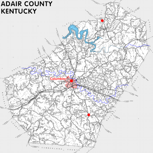
Adair county is in the Pennyrile region of Kentucky. The elevation in the county ranges from 585 to 1120 feet above sea level.
It was formed in 1802 from Green county. The county seat is Columbia. Adair county was a source of Wayne (1804), Russell (1826), Casey (1827), and Metcalfe (1860) counties.
In 2020 the county population was 18,903 in a land area of 405.28 square miles, an average of 46.6 people per square mile.
The equine population was 3,400 in the 2012 Kentucky Equine Survey.
Adair county is in the Lake Cumberland Area Development District. It is in the Appalachian region according to the Appalachian Regional Commission.
Adair county was named to honor General John Adair, who also served as governor of Kentucky.


SEARCH THE KENTUCKY ATLAS & GAZETTEER
© 2026 David C. Elbon
