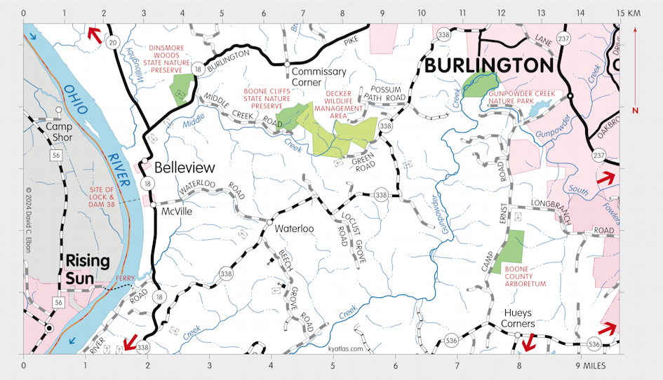
Belleview, Kentucky

Belleview is a Boone county community on the Ohio River about six miles southwest of Burlington. There are various stories about the name: for the attractive view of the river, for an alarm bell in the town, or perhaps from the old French name for the river, La Belle Rivière. The post office was always Grant, which was named for a local land owner, probably because variations of the name Belleview were already in use elsewhere in the state. The town was laid out in 1815 as Mount Vernon, perhaps for George Washington's home, but was renamed Belleview.
The Grant post office opened in 1869 and closed in 1974. The post office building, built circa 1880 and used as the post office beginning about 1920, was added to the National Register of Historic Places in 1990. The building was moved from its original location on Main Street to Sycamore Street.
The population of the Belleview census designated place was 308 in 2020 in a land area of 1.36 square miles.
Near Belleview was the Ohio River Lock and Dam 38. The upstream dam 37 was near Taylorsport and the downstream dam 39 was near Warsaw. Lock and Dam 38, also known as the McVille Lock and Dam, was built circa 1926 and demolished about 1964 after the completion of the downstream Markland Locks and Dam near Warsaw.
SEARCH THE KENTUCKY ATLAS & GAZETTEER
© 2026 David C. Elbon