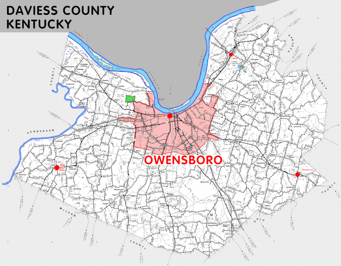
Daviess county is in the Western Coal Field region of Kentucky. The elevation in the county ranges from 347 to 680 feet above sea level.
It was formed in 1815 from Ohio county. The county seat is Owensboro. Daviess county was a source of Hancock (1829) and McLean (1854) counties.
In 2020 the county population was 103,312 in a land area of 458.35 square miles, an average of 225.4 people per square mile.
The equine population was 1,400 in the 2012 Kentucky Equine Survey.
Daviess county is in the Owensboro metro statistical area and the Green River Area Development District.
Daviess county was named to honor Joseph Hamilton Daveiss, who served as United States District Attorney and in the military. The spelling of the county name is inexplicably different than the spelling he used.


SEARCH THE KENTUCKY ATLAS & GAZETTEER
© 2026 David C. Elbon
