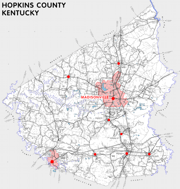
Hopkins county is in the Western Coal Field region of Kentucky. The elevation in the county ranges from 345 to 729 feet above sea level.
It was formed in 1807 from Henderson county. The county seat is Madisonville. Hopkins county was a source of Webster (1860) county.
In 2020 the county population was 45,423 in a land area of 542.00 square miles, an average of 83.8 people per square mile.
The equine population was 1,900 in the 2012 Kentucky Equine Survey.
Hopkins county is in the Madisonville micro statistical area and the Pennyrile Area Development District.
Hopkins county was named for General Samuel Hopkins, who served in the American Revolution and later in the Kentucky and United States legislatures.


SEARCH THE KENTUCKY ATLAS & GAZETTEER
© 2026 David C. Elbon
