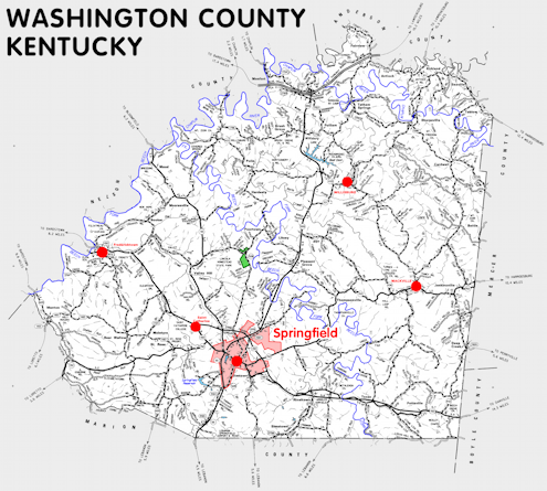
Washington county is in the Outer Bluegrass region of Kentucky. The elevation in the county ranges from 475 to 1020 feet above sea level.
It was formed in 1792 from Nelson county. The county seat is Springfield. Washington county was a source of Anderson (1827) and Marion (1834) counties.
In 2020 the county population was 12,027 in a land area of 297.27 square miles, an average of 40.5 people per square mile.
The equine population was 1,900 in the 2012 Kentucky Equine Survey.
Washington county is in the Lincoln Trail Area Development District.
Washington county was named to honor George Washington, who was President of the United States when the county was formed.
Washington county was the home of the family of Abraham Lincoln's mother, Nancy Hanks, after they left Virginia in 1784. The house is preserved at Lincoln Homestead State Park, north of Springfield.


SEARCH THE KENTUCKY ATLAS & GAZETTEER
© 2026 David C. Elbon
