Franklinville, Kentucky

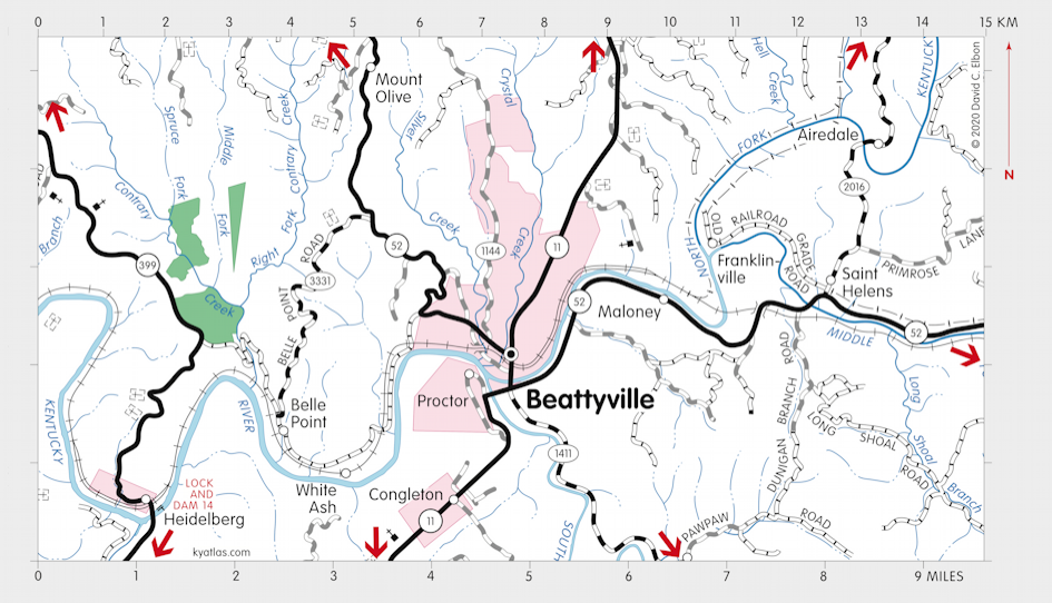
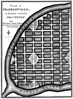
Franklinville was a proposed town that was to be located where the North and Middle Forks of the Kentucky River meet in what is now Lee county (at the time it was within Mason county). It was planned about 1794 and lots where to be sold from an office in London (England), but the town wasn't built. The site is just above the present town of Beattyville.
From William Winterbotham's An Historical, Geographical, Commercial, and Philosophical View of the American United States and of the European Settlements in America and the West-Indies (London, 1795)

The township of Franklin contains one hundred and sixteen thousand six hundred and fifty-six acres, and is most commodiously situated between two capital branches of that fine river which gives name to the State, the banks of which are better peopled than any other part of the State; on which lie the city of Lexington, the towns of Boonsborough, Danville, Grenville, Lees-town, &c. affording markets to the farmer for his produce. The river, about two hundred yards wide at the spot appropriated for a town already planned, to be called Franklinville, is navigable for large craft many miles above, and by the deep creeks into its interior parts for boats of considerable burthen.
In this township the farmer will have no need of manuring his grounds for many years to come, nature having already replenished the soil with a stock not soon to be exhausted. A considerable part of the land is of the prime quality, the second and third qualities are full strong enough for the various productions of the staples of life for man and beast.
Coal of a superior quality abounds within the limits, and in spots near the waters, and convenient for navigation to other parts of the country. There are two salt springs near the river, and a large quantity of copperas. The designed town is planned for the point at the confluence of the north and middle branches into the main river. Mason county, in which this township stands, will doubtless be soon divided into, at least, two more, and one will form a natural angle from this point, and probably be bounded by Red river, and Franklinville become the shire town.
SEARCH THE KENTUCKY ATLAS & GAZETTEER
© 2026 David C. Elbon