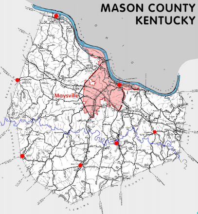
Mason county is in the Outer Bluegrass region of Kentucky. The elevation in the county ranges from 485 to 1000 feet above sea level.
It was formed in 1789 from Bourbon county. The county seat is Maysville. Mason county was a source of Campbell (1795), Bracken (1797), Fleming (1798), Floyd (1800), Nicholas (1800), Greenup (1804), and Lewis (1807) counties.
In 2020 the county population was 17,120 in a land area of 240.13 square miles, an average of 71.3 people per square mile.
The equine population was 1,000 in the 2012 Kentucky Equine Survey.
Mason county is in the Maysville micro statistical area and the Buffalo Trace Area Development District.
Mason county was formed while still part of Virginia and named for George Mason, one of the authors of the United States Bill of Rights.
The county seat was originally Washington; it was moved to Maysville in 1848.


SEARCH THE KENTUCKY ATLAS & GAZETTEER
© 2026 David C. Elbon
