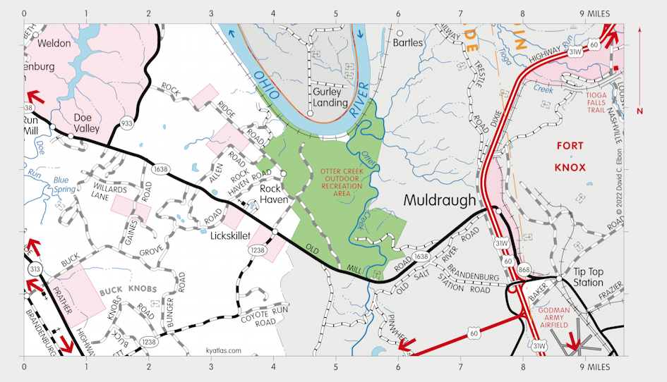
Ohiopiomingo, Kentucky

Ohiopiomingo was a proposed town probably in what is now Meade county on the Ohio River near the mouth of Otter Creek and Rock Haven. (When it was advertised in the 1790s it was in Nelson county.) The exact location is hard to pinpoint. It was promoted as being on the Ohio, near the mouth of Salt River, and 25 miles below the rapids (probably the falls of the Ohio at Louisville), which would be closer to West Point. The plan of the town shows it including the mouth of Otter Creek and the mouth of Doe Run, but has them incorrectly placed. The latitude and longitude on the plan is closer to Owensboro.
The town was advertised as having over a thousand house lots with both town lots and 500 acre farm tracts for each resident. There would be various public buildings and a college for the education of "the youth of the tenantry, and also for such children of the Indians as they may chuse to send thither for instruction." The name was "in compliment to Piomingo, one of the Indian chiefs, a man greatly beloved and respected, not only by the Indian tribes but also by the whites." (From An Historical, Geographical, Commercial, and Philosophical View of the American United States, and of the European Settlements in America and the West-Indies, 1799, by William Winterbotham.)
Ohiopiomingo was promoted by John Nicholson, of Pennsylvania, and his partners in the North American Land Company and later the Kentucky Land Company with other partners. They controlled six million acres across several states, including 400,000 in Kentucky. Although successful in earlier ventures, including large developments in Washington, D.C., the Kentucky scheme failed. Nicholson died in debtors' prison in Philadelphia in 1800. They also had proposed towns in Kentucky called Lystra and Franklinville. None were ever built.

SEARCH THE KENTUCKY ATLAS & GAZETTEER
© 2026 David C. Elbon