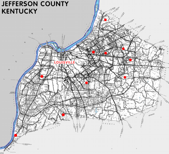
Jefferson county is in the Outer Bluegrass region of Kentucky. The elevation in the county ranges from 383 to 902 feet above sea level.
It was formed in 1780. The county seat is Louisville. Jefferson county was a source of Nelson (1785), Shelby (1792), Bullitt (1797), and Oldham (1824) counties.
In 2020 the county population was 782,969 in a land area of 380.42 square miles, an average of 2058.2 people per square mile.
It is the most populous county and the most densely populated county in the state.
The equine population was 7,400 in the 2012 Kentucky Equine Survey.
Jefferson county is in the Louisville/Jefferson County metro statistical area and the KIPDA Area Development District.
Jefferson county was one of the original counties in Kentucky territory of Virginia. It was named for Thomas Jefferson, who was governor of Virginia at the time the county was formed.
The Louisville and Jefferson county governments are merged into the Louisville/Jefferson County Metro Government.
Most of Jefferson county is urban and there were more than 90 incorporated cities in the county, some of which were completely surrounded by Louisville, before the merger in 2003. More than 80 remain.
Incorporated Cities in Jefferson County
- Anchorage
- Audubon Park
- Bancroft
- Barbourmeade
- Beechwood Village
- Bellemeade
- Bellewood
- Blue Ridge Manor
- Briarwood
- Broeck Pointe
- Brownsboro Farm
- Brownsboro Village
- Cambridge
- Coldstream
- Creekside
- Crossgate
- Douglass Hills
- Druid Hills
- Fincastle
- Forest Hills
- Glenview
- Glenview Hills
- Glenview Manor
- Goose Creek
- Graymoor-Devondale
- Green Spring
- Heritage Creek
- Hickory Hill
- Hills and Dales
- Hollow Creek
- Hollyvilla
- Houston Acres
- Hurstbourne
- Hurstbourne Acres
- Indian Hills
- Indian Hills-Cherokee Section
- Jeffersontown
- Kingsley
- Langdon Place
- Lincolnshire
- Louisville/Jefferson County
- Lyndon
- Lynnview
- Manor Creek
- Maryhill Estates
- Meadow Vale
- Meadowbrook Farm
- Meadowview Estates
- Middletown
- Mockingbird Valley
- Moorland
- Murray Hill
- Norbourne Estates
- Northfield
- Norwood
- Old Brownsboro Place
- Parkway Village
- Plantation
- Poplar Hills
- Prospect
- Richlawn
- Riverwood
- Robinswood
- Rolling Fields
- Rolling Hills
- Saint Matthews
- Saint Regis Park
- Seneca Gardens
- Shively
- South Park View
- Spring Mill
- Spring Valley
- Strathmoor Manor
- Strathmoor Village
- Sycamore
- Ten Broeck
- Thornhill
- Watterson Park
- Wellington
- West Buechel
- Westwood
- Wildwood
- Winding Falls
- Windy Hills
- Woodland Hills
- Woodlawn Park
- Worthington Hills


SEARCH THE KENTUCKY ATLAS & GAZETTEER
© 2026 David C. Elbon
