Kentucky Atlas and Gazetteer

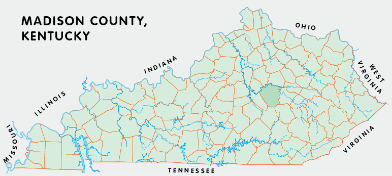
Madison County, Kentucky

Madison county is in the Eastern Knobs region of Kentucky. The elevation in the county ranges from 530 to 1660 feet above sea level.

It was formed in 1786 from Lincoln county. Madison county was a source of Garrard (1797), Clay (1807), Estill (1808), Rockcastle (1810), and Jackson (1858) counties. The county seat is Richmond.

In 2020 the county population was 92,701 in a land area of 437.29 square miles, an average of 212.0 people per square mile.

The equine population was 3,100 in the 2012 Kentucky Equine Survey.

Madison county is in the Richmond-Berea micro statistical area and the Bluegrass Area Development District. It is in the Appalachian region according to the Appalachian Regional Commission.

Madison county was formed while the area was still part of Virginia and probably named for James Madison, who was then in the Virginia legislature. The original county seat was Milford, but it was moved to Richmond in 1798.

Many early settlers passed through Madison county. Fort Boonesborough was established near the Kentucky River in 1775. Several ferries across the Kentucky once operated in the county, beginning with one at Boonesborough in 1779. A ferry still operates at Valley View, where Tates Creek enters the Kentucky River.

Madison county is the home of the Lexington-Blue Grass Army Depot, Eastern Kentucky University in Richmond, and Berea College in Berea.


Census Census Data Madison County Details Kentucky Counties Google Map County Map Historical Markers National Register Cooperative Extension Adair County Allen County Anderson County Ballard County Barren County Bath County Bell County Boone County Bourbon County Boyd County Boyle County Bracken County Breathitt County Breckinridge County Bullitt County Butler County Caldwell County Calloway County Campbell County Carlisle County Carroll County Carter County Casey County Christian County Clark County Clay County Clinton County Crittendon County Cumberland County Edmonson County Elliott County Estill County Fayette County Fleming County Floyd County Franklin County Gallatin County Fulton County Garrard County Grant County Graves County Grayson County Green County Greenup County Hancock County Hardin County Harlan County Harrison County Hart County Henderson County Henry County Hopkins County Jackson County Jefferson County Jessamine County Johnson County Kenton County Knott County Knox County LaRue County Laurel County Lawrence County Lee County Leslie County Letcher County Lewis County Lincoln County Livingston County Logan County Lyon County McCracken County McCreary County McLean County Madison County Magoffin County Marion County Marshall County Mason County Martin County Meade County Menifee County Mercer County Metcalfe County Monroe County Montgomery County Morgan County Muhlenberg County Nelson County Nicholas County Ohio County Oldham County Owen County Owsley County Pendleton County Perry County Pike County Powell County Pulaski County Robertson County Rockcastle County Rowan County Russell County Scott County Shelby County Simpson County Spencer County Taylor County Todd County Trigg County Trimble County Union County Warren County Washington County Wayne County Webster County Whitley County Wolfe County Woodford County Daviess County Hickman County State of West Virginia State of Ohio Commonwealth of Virginia State of Tennessee State of Missouri State of Illinois State of Indiana
SEARCH THE KENTUCKY ATLAS & GAZETTEER

© 2025 David C. Elbon