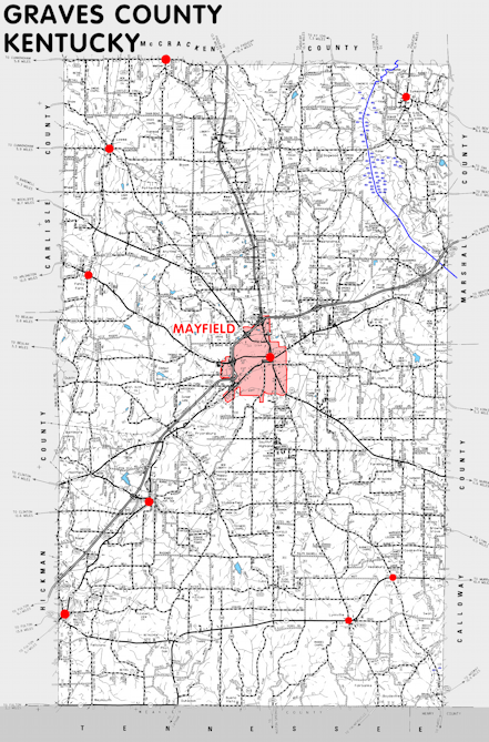
Graves county is in the Jackson Purchase region of Kentucky. The elevation in the county ranges from 321 to 580 feet above sea level.
It was formed in 1824 from Hickman county. The county seat is Mayfield.
In 2020 the county population was 36,649 in a land area of 551.74 square miles, an average of 66.4 people per square mile.
The equine population was 2,400 in the 2012 Kentucky Equine Survey.
Graves county is in the Mayfield micro statistical area and the Purchase Area Development District.


SEARCH THE KENTUCKY ATLAS & GAZETTEER
© 2026 David C. Elbon
