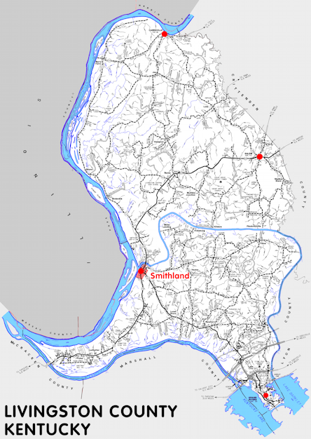
Livingston county is in the Pennyrile region of Kentucky. The elevation in the county ranges from 302 to 754 feet above sea level.
It was formed in 1799 from Christian county. The county seat is Smithland. Livingston county was a source of Christian (1799), Caldwell (1809), Calloway (1821), Graves (1821), Hickman (1821), McCracken (1821), and Crittenden (1842) counties.
In 2020 the county population was 8,888 in a land area of 313.13 square miles, an average of 28.4 people per square mile.
The equine population was 1,200 in the 2012 Kentucky Equine Survey.
Livingston county is in the Paducah micro statistical area and the Pennyrile Area Development District.
Livingston county was named to honor Robert R. Livingston, a lawyer and diplomat and one of the drafters of the Declaration of Independence.
When Livingston county was formed it was much larger than its present size and the county seat was Eddyville, now in Lyon county, and a courthouse was built there in 1801. The county seat was moved to Centerville, now in Crittenden county, in 1804 and then to Salem in 1809. Smithland became the seat in 1841 when Crittenden county was formed.


SEARCH THE KENTUCKY ATLAS & GAZETTEER
© 2026 David C. Elbon
