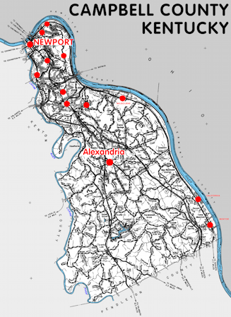
Campbell county is in the Outer Bluegrass region of Kentucky. The elevation in the county ranges from 455 to 920 feet above sea level.
It was formed in 1795 from Harrison, Mason, and Scott counties. The county seats are Alexandria and Newport. Campbell county was a source of Bracken (1797), Pendleton (1799), Boone (1799), and Kenton (1840) counties.
In 2020 the county population was 93,076 in a land area of 151.31 square miles, an average of 615.1 people per square mile.
The equine population was 1,800 in the 2012 Kentucky Equine Survey.
Campbell county is in the Cincinnati metro statistical area and the Northern Kentucky Area Development District.
Campbell county was named for John Campbell, an early Kentucky land owner and member of the state legislature.
The initial county seat was Wilmington, now known as Burlington and in Boone county. In 1797 it was moved to Newport, then in 1823 it was moved to Visalia, now in Kenton county, back to Newport in 1824, and then in 1840 to Alexandria, although some functions remain in Newport.


SEARCH THE KENTUCKY ATLAS & GAZETTEER
© 2026 David C. Elbon
