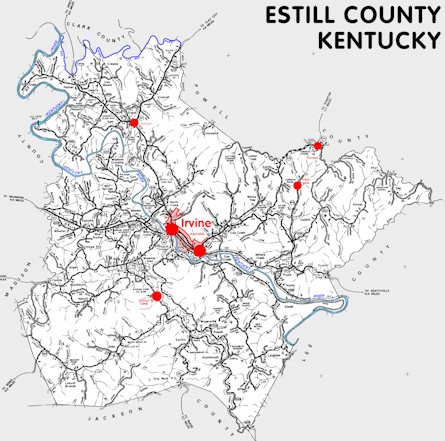
Estill county is in the Eastern Knobs and Eastern Coal Field regions of Kentucky. The elevation in the county ranges from 566 to 1511 feet above sea level.
It was formed in 1808 from Clark and Madison counties. The county seat is Irvine. Estill county was a source of Breathitt (1839), Owsley (1843), Powell (1852), Jackson (1858), and Lee (1870) counties.
In 2020 the county population was 14,163 in a land area of 253.08 square miles, an average of 56.0 people per square mile.
The equine population was 1,000 in the 2012 Kentucky Equine Survey.
Estill county is in the Richmond-Berea micro statistical area and the Bluegrass Area Development District. It is in the Appalachian region according to the Appalachian Regional Commission.
Estill county was named for Captain James Estill, an early settler in what is now Madison county.
Much of Estill county lies within the Daniel Boone National Forest.


SEARCH THE KENTUCKY ATLAS & GAZETTEER
© 2026 David C. Elbon
