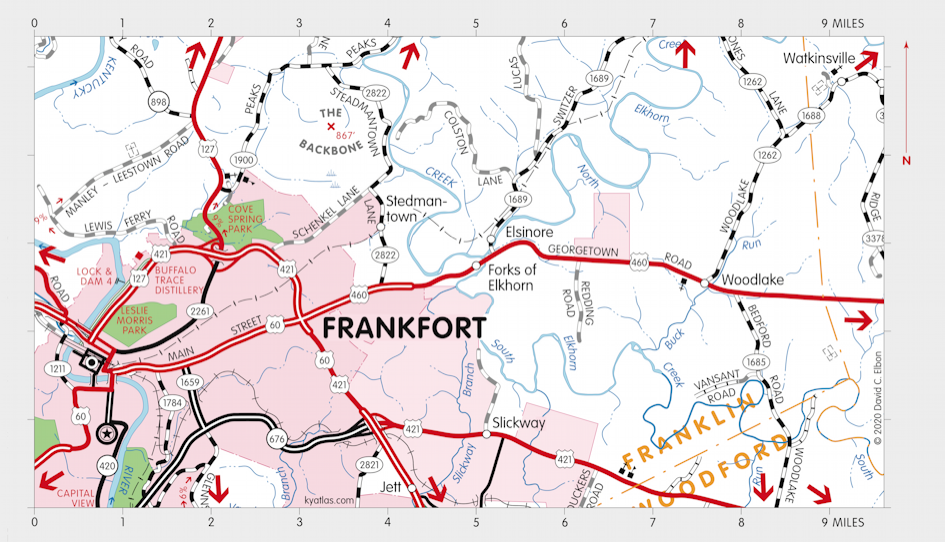
Elkhorn Creek

Elkhorn Creek is an Inner Bluegrass stream that runs for 86 miles through Fayette, Scott, Woodford, and Franklin counties. It meets the Kentucky River in northern Franklin county near Peaks Mill. The two main branches, North Elkhorn Creek and South Elkhorn Creek, meet at Forks of Elkhorn just east of Frankfort.
From Jedidiah Morse's The American Geography (London, 1794)
Elkhorn river, a branch of the Kentucky, from the south-east, waters a country fine beyond description. Indeed, the country east and south of this, including the head waters of Licking river, Hickman's and Jessamine Creeks, and the remarkable bend in Kentucky river, may be called an extensive garden. The soil is deep and black, and the natural growth, large walnuts, honey and black locust, poplar, elm, oak, hickory, sugar tree, &c. Grape vines run to the tops of the trees; and the surface of the ground is covered with clover, blue grass, and wild rye. On this fertile track, and the Licking river, and the head waters of Salt river, are the bulk of the settlements in this country. The soil within a mile or two of Kentucky river is generally of the third and fourth rates; and as you advance towards the Ohio, the land is poor and hilly.
SEARCH THE KENTUCKY ATLAS & GAZETTEER
© 2026 David C. Elbon